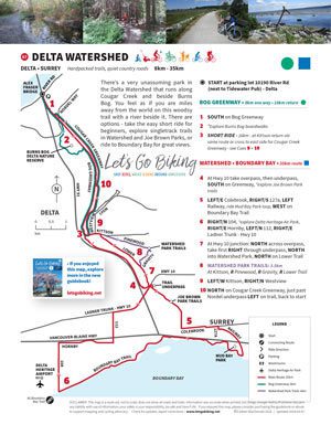
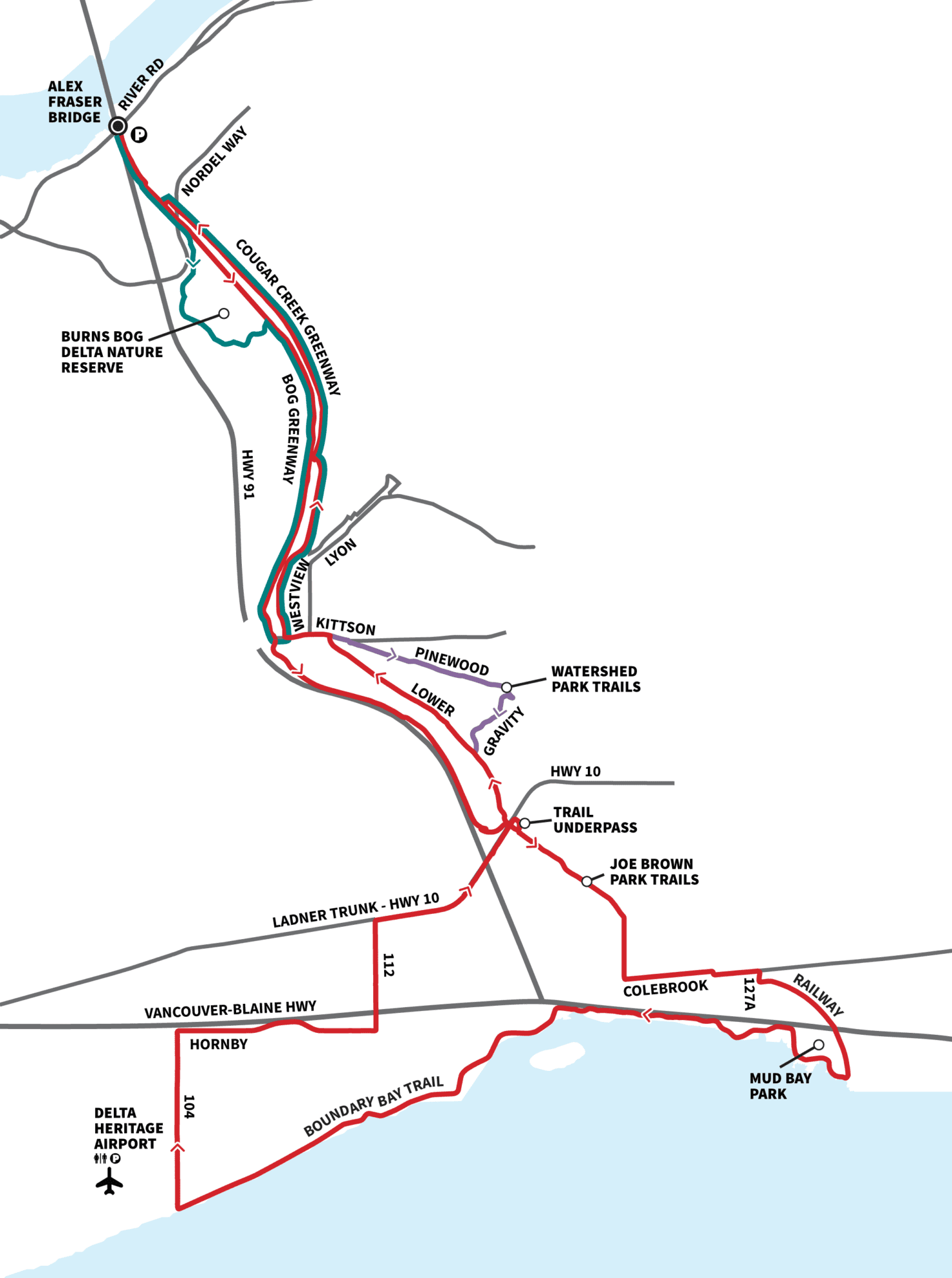
A quiet, shaded ride through Burns Bog with winding creekside trails and plenty of ways to explore.
Distance
8km • 35km
Terrain
Hardpacked trails, quiet country roads
There’s a very unassuming park in the Delta Watershed that runs along Cougar Creek and beside Burns Bog.
You feel as if you are miles away from the world on this woodsy trail with a meandering river beside it.
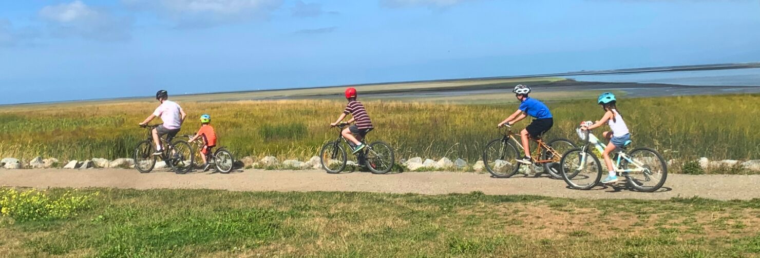
There are options – take the easy short ride for beginners, explore singletrack trails in Watershed and Joe Brown Parks, or ride to Boundary Bay for great views.
Route
- Start at River Road
- Follow Bog Greenway south
- Explore Burns Bog boardwalks and Joe Brown trails
- Continue toward Boundary Bay
Highlights
- Burns Bog
- Wooded trails
- Cougar Creek


“Quiet, green, and surprisingly expansive once you get going.” ~ Colleen
plan your ride
- View this ride on the Google map
- GPX Tracks (full route)
Let’s Go Biking Community Alerts:
Trail Flooded: (2026) the trail on the west side of Cougar Creek is currently flooded and impassible by bike. Delta is working with DFO and other organizations to hopefully alleviate this issue and restore access soon. In the meantime, the best detour is the North Delta Greenway, high and dry on the east side of Cougar Creek.
Beavers at Work! In the winter, the trail on the west side of the creek is often flooded or muddy. There is a parallel trail on the east side of the creek between 72 Avenue and Nordel Way.
ProofRider Bob says, “If I could offer one suggestion that might help other riders choosing the Watershed ride, it would be how to easily find where the ride commences on River Rd. We spent quite a bit of time determining exactly where we got onto the “Greenway”, as it’s quite obscure and not easily seen from the road. If it simply noted that: “the ride commences right next door to the Tidewater Pub, on the west side”, it might help other riders.”